


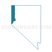
Precinct No. 7421, Washoe County, Nevada
About
Outline

Summary
| Unique Area Identifier | 616018 |
| Name | Precinct No. 7421 |
| County | Washoe County |
| State | Nevada |
| Area (square miles) | 139.75 |
| Land Area (square miles) | 139.72 |
| Water Area (square miles) | 0.03 |
| % of Land Area | 99.98 |
| % of Water Area | 0.02 |
| Latitude of the Internal Point | 39.94581500 |
| Longtitude of the Internal Point | -119.73873880 |
Maps


Graphs
Select a template below for downloading or customizing gragh for Precinct No. 7421, Washoe County, Nevada


Neighbors
Neighoring Voting District (by Name) Neighboring Voting District on the Map
- Precinct No. 7409, Washoe County, NV
- Precinct No. 7411, Washoe County, NV
- Precinct No. 7422, Washoe County, NV
- Precinct No. 7547, Washoe County, NV
- Precinct No. 9404, Washoe County, NV
- Precinct No. 9407, Washoe County, NV
- Precinct No. 9518, Washoe County, NV
- Precinct No. 9519, Washoe County, NV
Top 10 Neighboring County Subdivision (by Population) Neighboring County Subdivision on the Map
- Warm Springs-Truckee Canyon CCD, Washoe County, NV (52,378)
- North Valleys CCD, Washoe County, NV (51,813)
- Pyramid Lake CCD, Washoe County, NV (1,654)
- High Desert CCD, Washoe County, NV (567)